June 13-16, 2018
Icefields Parkway
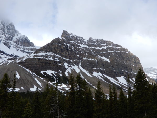
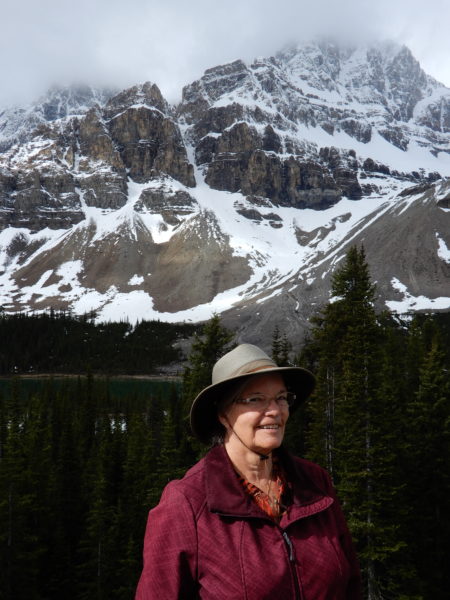
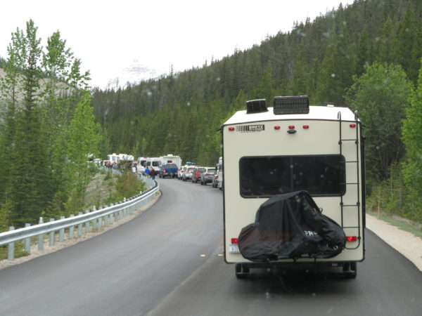
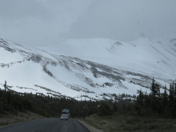
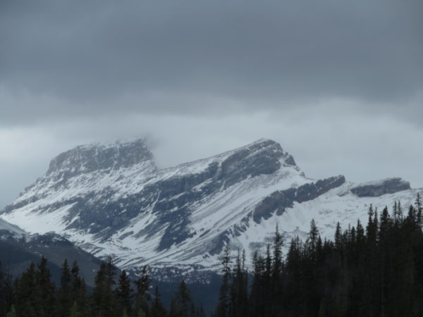
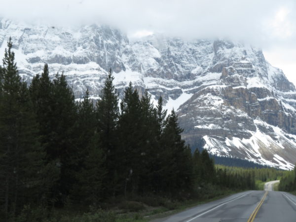
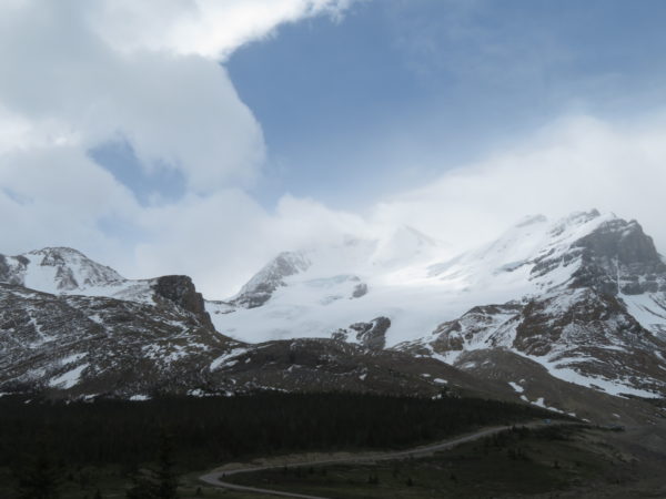
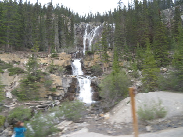
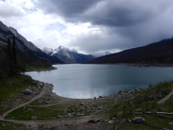
Banff and Jasper National Parks are connected by the Icefields Parkway, considered by many (including us) to be one of the most scenic drives in the world. The parkway stretches 232 kilometers winding along the Continental Divide. It is dotted with more than 100 ancient glaciers, cascading waterfalls, dramatic rock spires and emerald lakes set in sweeping valleys of thick pine and larch forest. At the highest point on the parkway is the Columbia Icefield which is made up of several different glaciers. The Athabasca Glacier stretches almost to the road. We stopped at the Columbia Icefield Centre to take pictures and get information about the tours and hikes you can take on the glacier. The wind was howling and the temperature freezing while we were there.
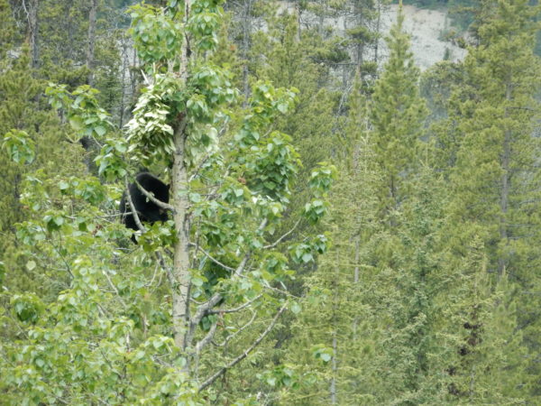
A black bear in a tree.
The result of a bear in a tree.
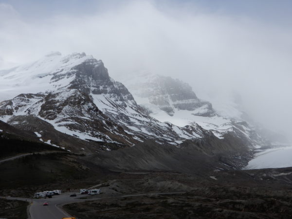
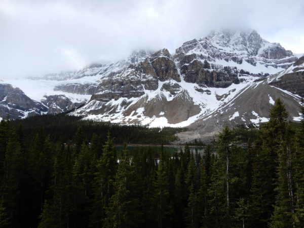
The Columbia Icefield.
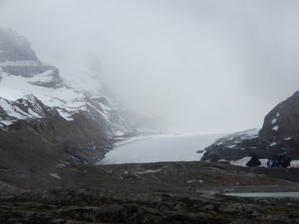
The Athabasca Glacier.
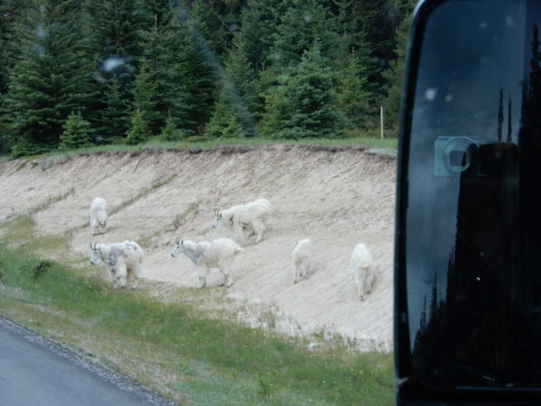
Mountain Goats licking the salts or minerals out of the soil. They’re even harder to see in the snow.
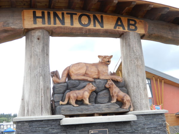
Hinton, Alberta
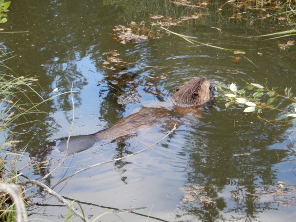
Our campground was about 50 miles northeast of Jasper National Park near Hinton, Alberta, a town of about 10,000 people. The town was named for William Hinton, vice president of the Grand Trunk Pacific Railway in 1911. Hinton was a small village until American entrepreneur Frank Seabolt opened the Hinton coal mine in 1931. The Great Depression shut down the mine a few years later and Hinton’s population dwindled to less than 100 people. With the opening of a pulp mill in the area in 1955, the town rebounded, amalgamated with the village of Drinnan and became the present town of Hinton in 1957. Hinton’s best attraction is the Beaver Boardwalk, a three-kilometer walk of paths and boardwalks through the wetlands and around the ponds and lake in Hinton.
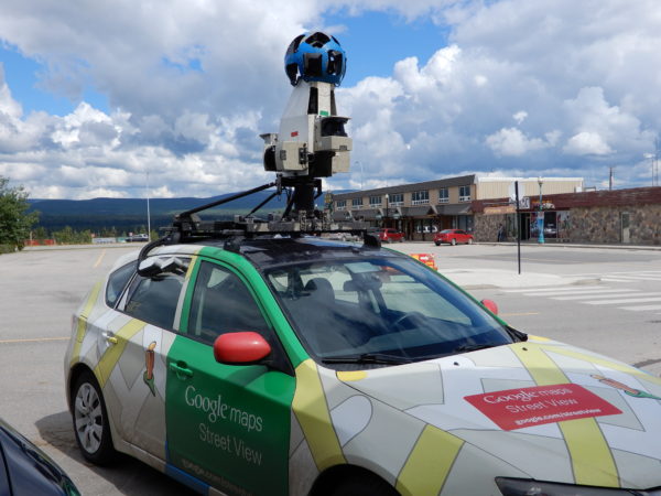
We stopped in Hinton for a coffee and a Google Maps Street View car was parked next to us.
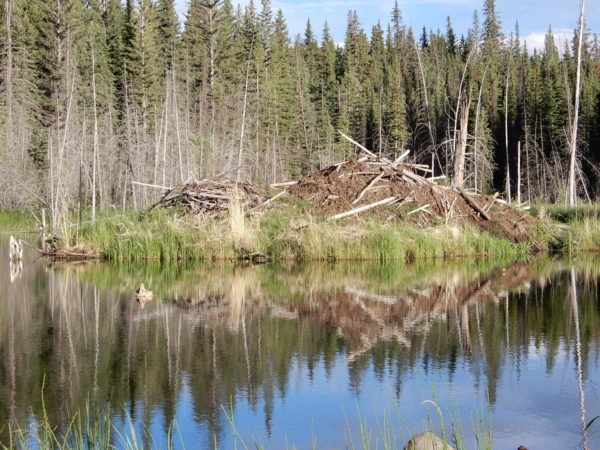
A beaver lodge at the Beaver Boardwalk in Hinton.
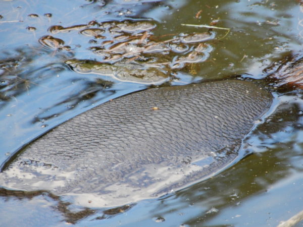
We didn’t know beaver tails look like fish scales.
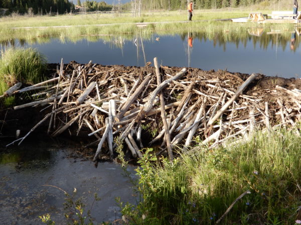
A beaver dam.
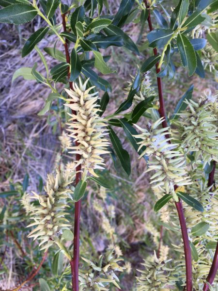
Canada has over 40 species of willows. This was one of the most unusual.
Jasper National Park
Jasper National Park is the largest national park in the Canadian Rockies, covering 4,200 square miles. Jasper was named after Jasper Hawes who operated a trading post in the region for the North West Company. The park was established in 1907 as Jasper Forest Park and was granted national park status in 1930. About 2,500,000 people are expected to visit the park this year. We believe it!
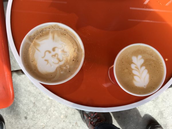
The best coffee we found in Jasper was in a laundromat. The barista made our drinks beautiful as well as delicious.
We visited several scenic areas.
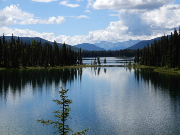
Maligne Lake and Canyon
Maligne Lake in Jasper National Park is the second largest glacier-fed lake in the world. It is famed for its color, beautiful surrounding peaks, the three glaciers visible from the lake, and Spirit Island. The lake is 14 miles long, 1 mile wide and up to 318 feet deep. The lake’s name derives from the French word for malignant or wicked and is now used for the river, canyon, lake and mountain range. The name was given by a priest on horseback in 1846 who had found the river wickedly hard to cross. The Maligne River flows into the northern part of the lake and flows out of the lake in a narrow channel to Medicine Lake. There is no visible outlet for Medicine Lake because the river flows underground for nine miles before reappearing in Maligne Canyon.
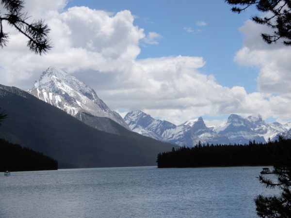
Maligne Lake and Pyramid Mountain
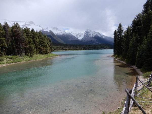
The Maligne River as it leaves Maligne Lake.
Looking downstream.
The bottom of Medicine Lake where the Maligne River begins to flow underground until reemerging at Maligne Canyon.
Maligne Canyon is a narrow canyon up to 180 feet deep. The limestone walls of the canyon, a karst formation, are easily soluble and this has resulted in numerous underground rivers that intersect the bedrock layers of the walls of the canyon. The canyon is quite steep with numerous waterfalls and streams that flow directly out of the canyon’s walls into the river, greatly increasing its volume.
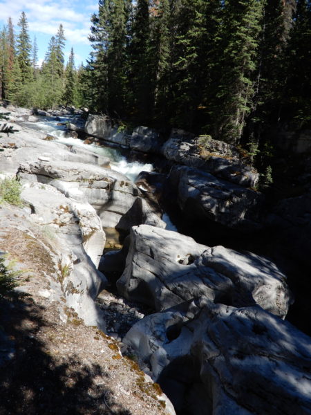
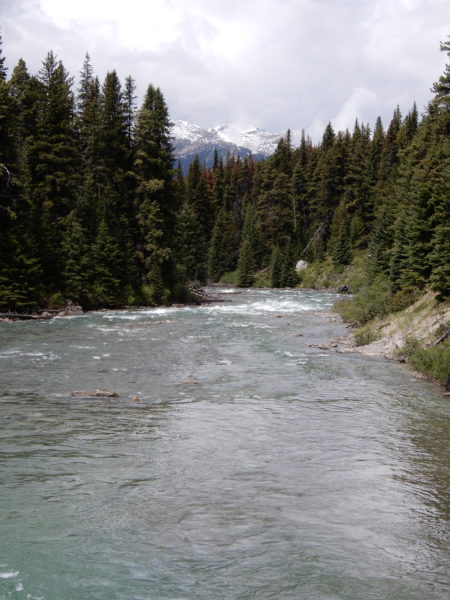
The Maligne River as it enters the canyon.
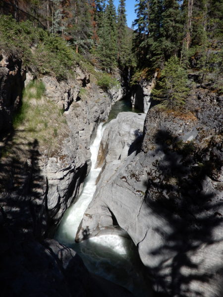
The first falls.
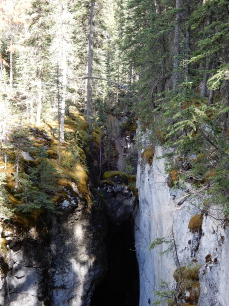
A boulder (chockstone) has fallen and wedged itself between the canyon walls. The canyon at this point is less than 10 feet wide but more than 120 feet deep.
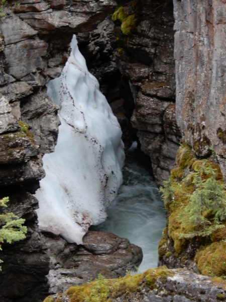
Snow was still clinging to the sides of the canyon.
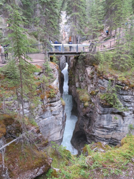
The first bridge across the canyon was built in 1914 and the 6th and last bridge in 1926. Without the bridges, it would be difficult to appreciate the depth and narrowness of the canyon.
A small waterfall joins the Maligne River
Jane on the 6th and largest bridge across the Maligne River.
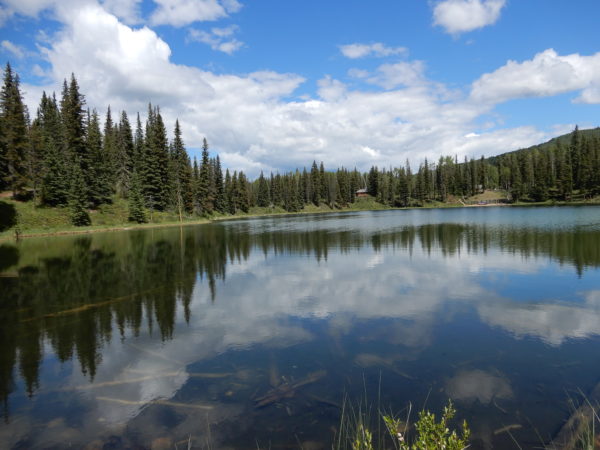
William A. Switzer Provincial Park
In the middle of this park is Jarvis Lake, a section of which is named Kelly’s Bathtub for a ranger who amused local residents by falling out of his canoe.
Jarvis Lake and Kelley’s Bathtub (foreground).
Kelley’s Bathtub.
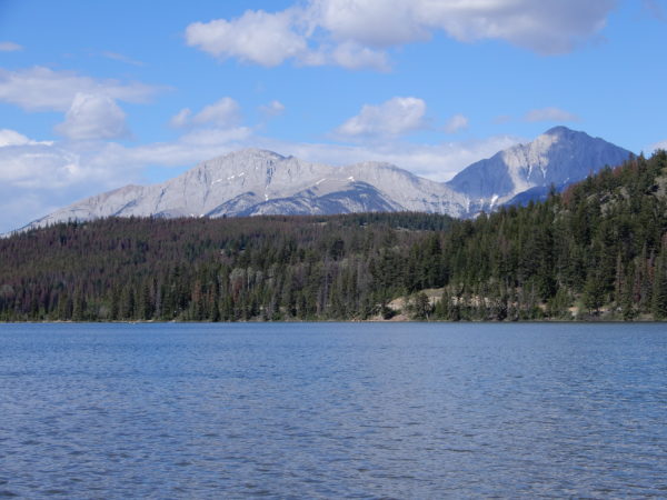
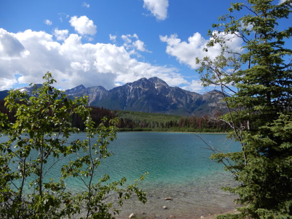
Patricia and Pyramid Lakes
Patricia and Pyramid Lakes are above the town of Jasper. Pyramid Lake is a kidney-shaped lake at the foot of Pyramid Mountain overlooking Jasper. The lake has picnic tables, hiking trails and a footbridge to an island in the middle of the lake.
Patricia Lake was named for Princess Patricia of Connaught, a granddaughter of Queen Victoria. Patricia Lake was notable for its involvement during World War II with Project Habbakuk, a plan to build an unsinkable aircraft carrier from an ice-based composite material called Pykrete. Pykrete was a water-sawdust material maintained by refrigeration. A model ship was built in 1943 by constructing a wood cabin on the lake, installing refrigeration equipment and a nest of six-inch cold air ducts, and then increasing the height of the ice walls around the cabin. As the weight increased, the bottom of the hull was sawn free from the lake ice and the model floated. In June the refrigeration equipment was switched off but the model lasted the whole summer before melting and sinking. The remains of the model ship are still on the lake’s bottom. An underwater plaque at the site commemorates the project’s place in World War II history. The idea for this novel ice ship originated from the observation that you can’t sink an iceberg and a torpedoed ice ship with a hole in the hull would still float.
Patricia Lake.
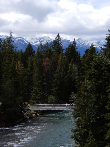
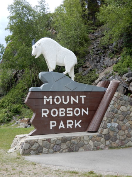
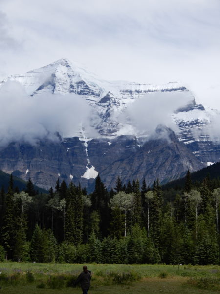
Mount Robson
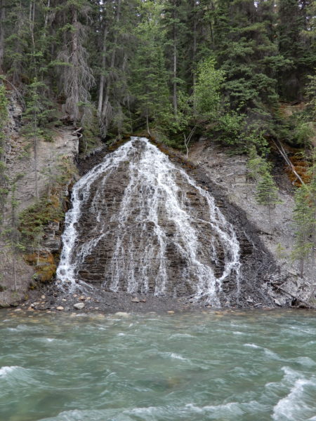
Mount Robson Provincial Park is located in British Columbia, bordering Jasper National Park in Alberta. The BC legislature created the park in 1913, the same year as the first ascent of Mount Robson by Conrad Kain. Mount Robson is the highest point in the Canadian Rockies at 12,972 feet. The Berg and Mist glaciers calve directly into Berg Lake at the mountain’s base. Mount Robson Provincial Park is also the source of the Fraser River, British Columbia’s longest river. We hiked into two waterfalls while visiting Mount Robson.
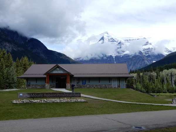
Park Headquarters with Mt Robson in the background.
Rearguard Falls on the Fraser River marks the upper limit of the 800 miles migration of salmon from the Pacific Ocean. Only a few Chinook, the largest and strongest of the salmon, come this far upstream.
Overlander Falls was named for a large group of prospectors who in August of 1862 camped near the falls on their journey from Ontario to the goldfields of British Columbia.
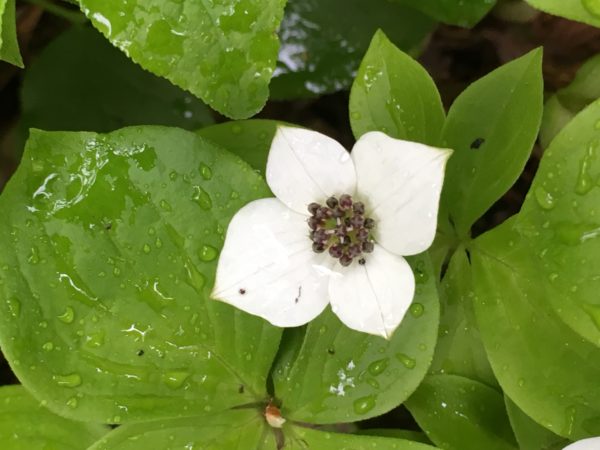
Bunchberry, or creeping dogwood
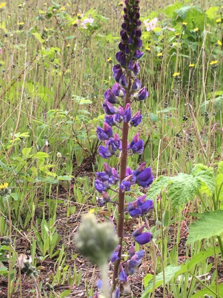
Arctic lupine
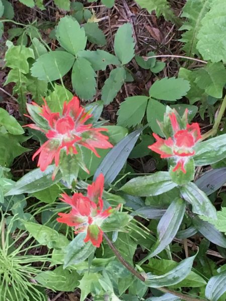
Maybe an Indian paintbrush
3 Comments
Madhuri Land · July 30, 2018 at 2:39 pm
Absolutely gorgeous photos and videos. An the narrative is so interesting!! Thank you so much for sharing!!!
Alice McGregor · August 3, 2018 at 9:24 pm
Just gorgeous! Especially loved the variety of water features. Just back from Lake of the Woods, Ont.
Susan · August 7, 2018 at 4:59 pm
I loved my time in Jasper and seeing some of the same sights brought back lots of happy memories. Going back is on the bucket list!!!