June 25-28, 2018
Alaska Highway, Milepost 918
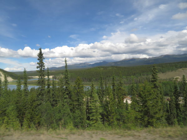
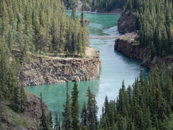
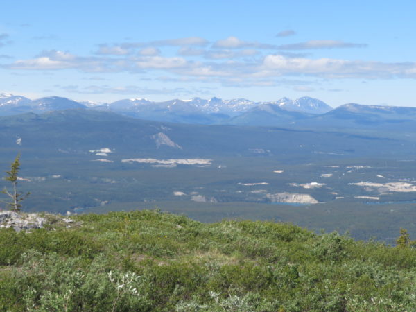
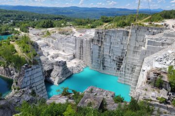
This travel day was a pretty one as these three photos show.
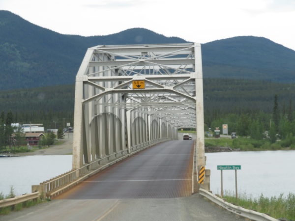
Nisutlin Bay Bridge, the second longest water span on the Alaska Highway, is 1,917 feet long. It crosses a bay of Teslin Lake.
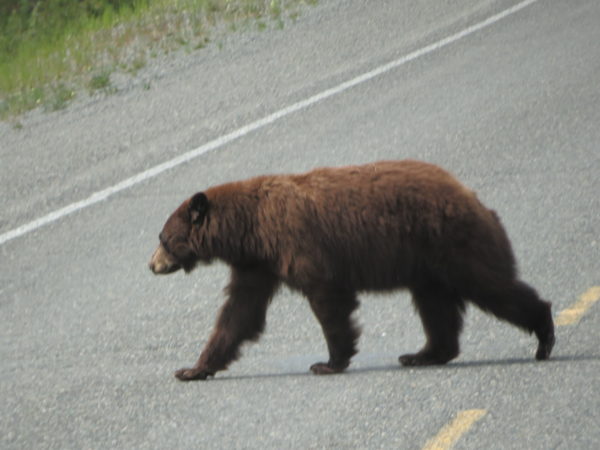
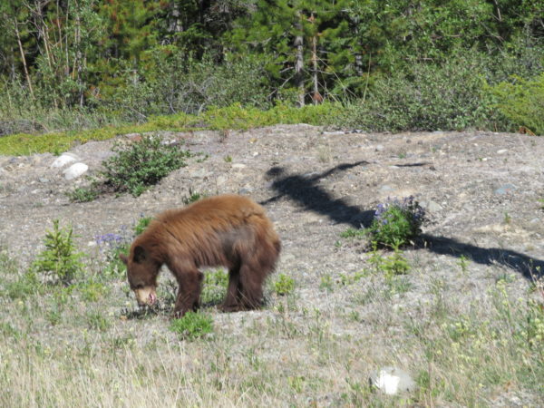
A black bear (its color is less a factor in identification than its lack of a hump between its shoulders) crosses in front of us.
The city of Whitehorse is on the upper reaches of the Yukon River and is the capital of the Yukon Territory. The territory has an area larger than that of California with a population of 38,000. Two-thirds of that population lives in Whitehorse. The northern terminus of the White Pass and Yukon River Railway connected the Yukon River with Skagway in 1900 and spurred growth in the area. Steamboats were available to carry passengers on to Dawson City, about 350 miles north, and on to the Bering Sea, some 1,500 miles north. No highway, however, served the city until the completion of the Alaska Highway in 1942. The city was named because nearby foaming rapids resembled white horses’ manes.
Whitehorse’s economic base includes mining, tourism, retail, and government.
We understand why tourism is popular. We had fun just being in the city.
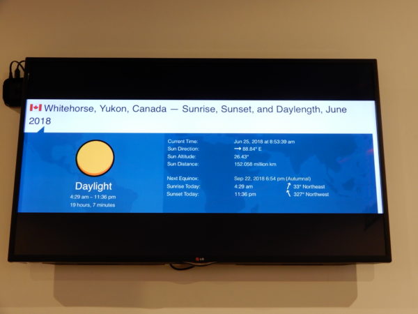
As you see, we had lots of daylight! This display was in the Visitors Center.
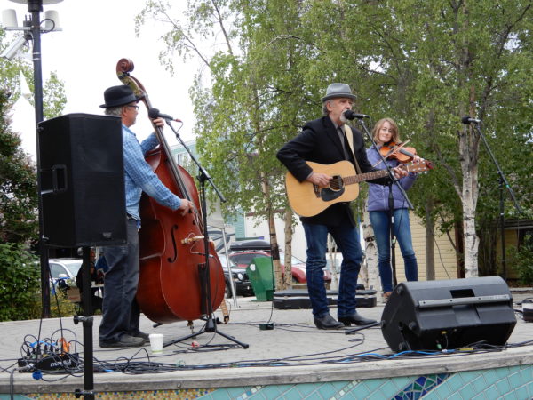
Music in the park at lunchtime.
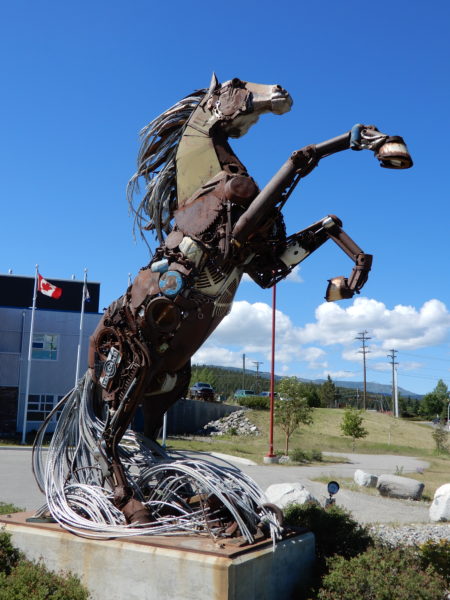
The pieces used to construct this statue were donations made by Yukoners.
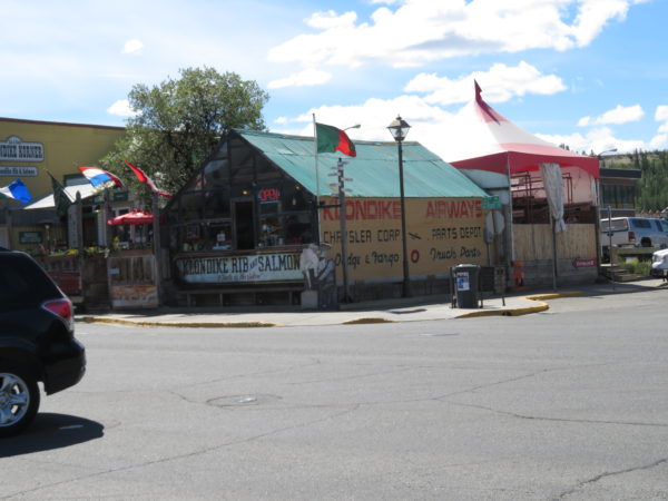
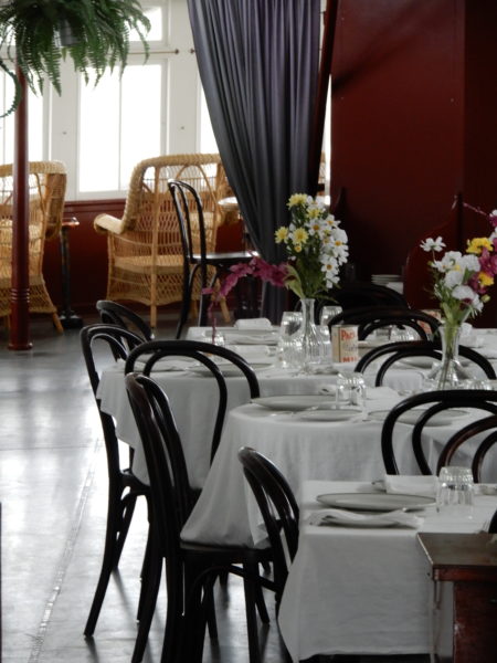
The restaurant Klondike Rib and Salmon is housed in two of the oldest buildings in Whitehorse. Fun and delicious!
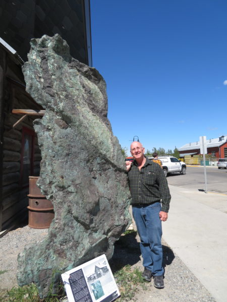
This three-ton copper slab took 15 people five days to move from the woods to the McBride Museum 250 miles away.
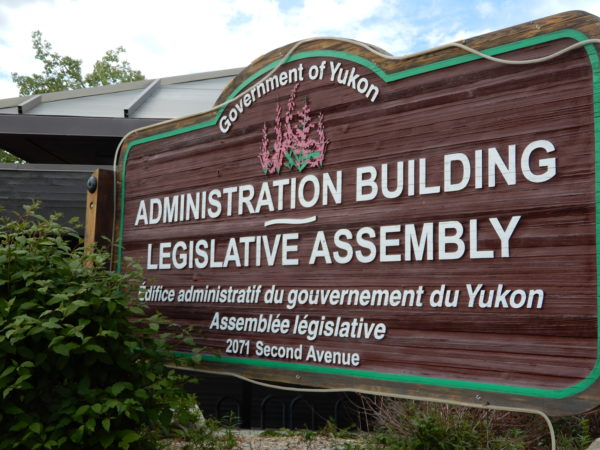
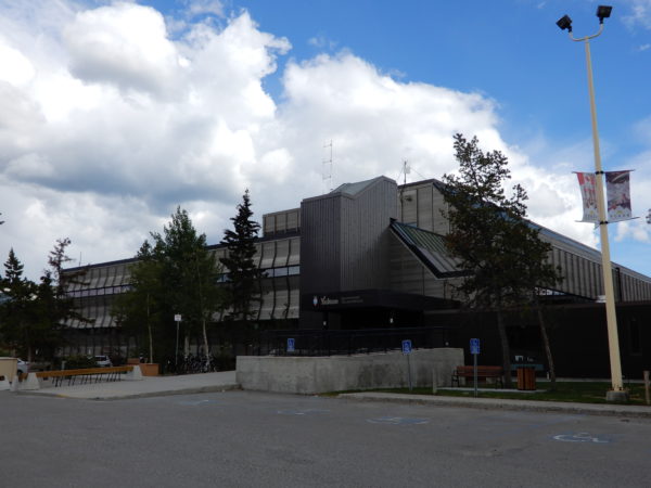
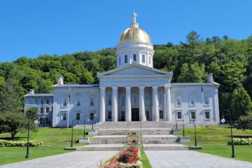
Yukon Legislative Building
The Yukon Territorial Government moved to Whitehorse in 1953. We visited the building that houses the legislature and asked about seeing it. Floyd McCormick, Clerk of the Legislative Assembly, was kind enough to give us a guided tour. We noticed that although the building’s architecture is contemporary, it contains traditional elements like the Mace, arches, and art.
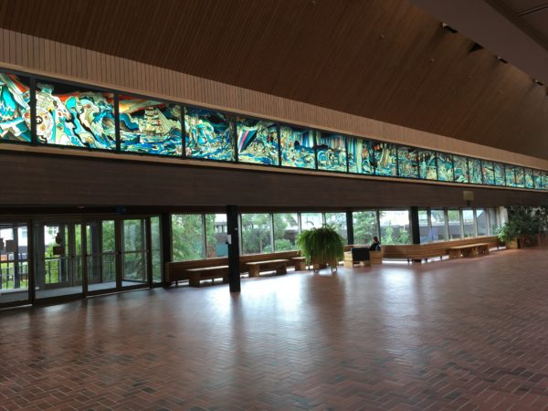
Lobby
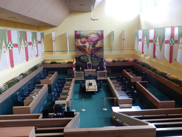
Assembly Chambers. There are two types of banners: The ones with wavy vertical stripes represent the Yukon River and the gold-bearing creeks of the Klondike. The triangles are mountains and the gold circles represent minerals. The red cross on the other banners is the Cross of St. George to honor the English explorers. Underneath is a heraldic symbol of wealth representing the fur trade.
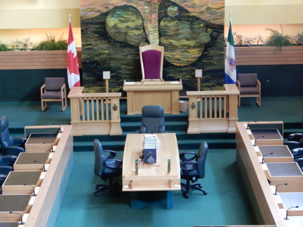
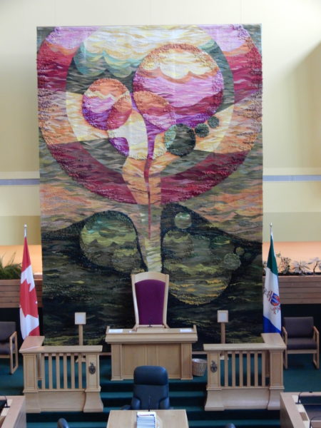
The tapestry is “Fireweed” and is meant to evoke the natural resources and landscapes of Yukon.
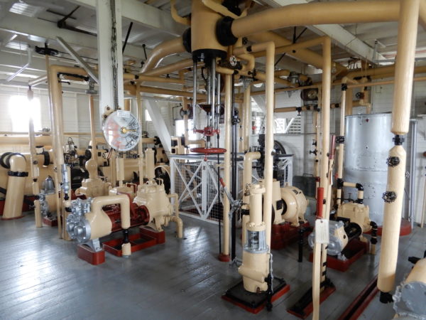
S. S. Klondike
The Klondike was built in 1929 by the British Yukon Navigation Company. It was the largest sternwheeler in the Yukon with a cargo capacity fifty percent greater than previous boats. It could carry 300 tons. It carried mail, general supplies, passengers, and silver-lead ore along a 460-mile route to Dawson City until 1955.
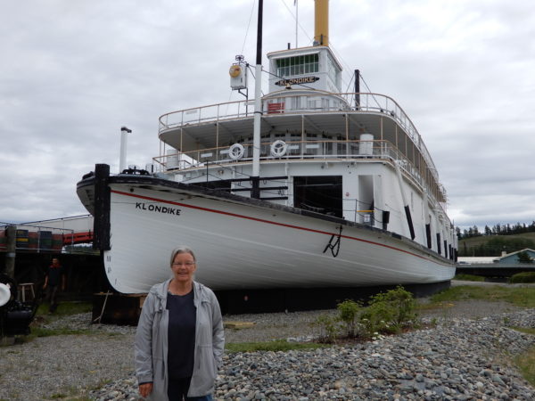
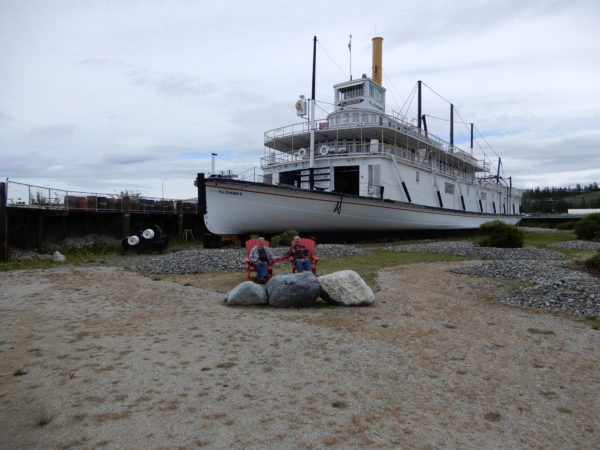
Jane and Dave in Parks Canada’s red chairs in front of the Klondike
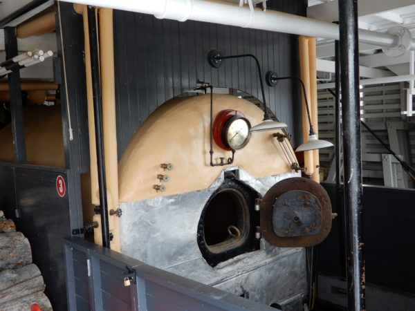
Firebox. The Klondike burned an average of one cord of wood an hour going upstream.
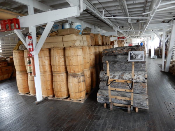
Wood and cargo
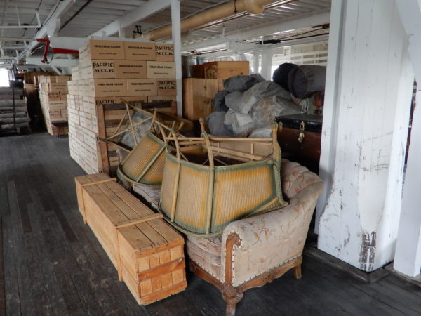
Cargo
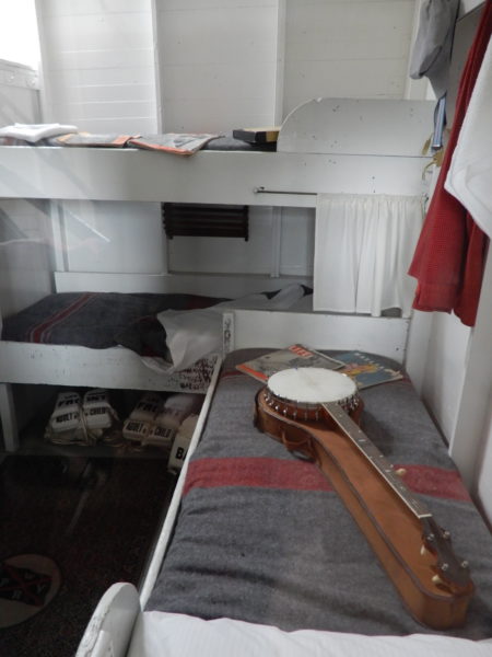
Crew quarters
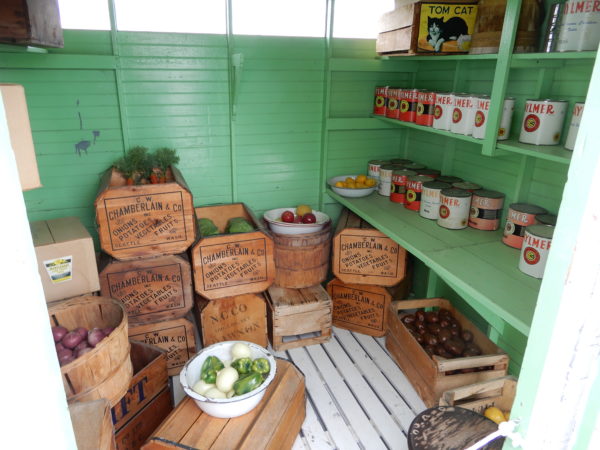
Pantry
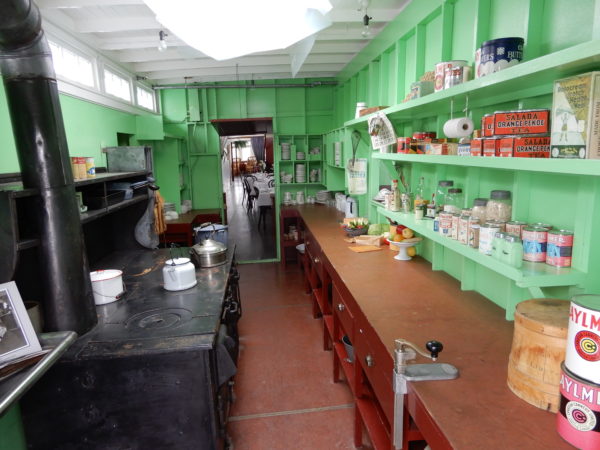
Kitchen
Dining Room
Yukon Beringia Interpretive Center
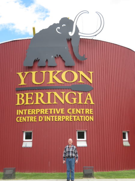
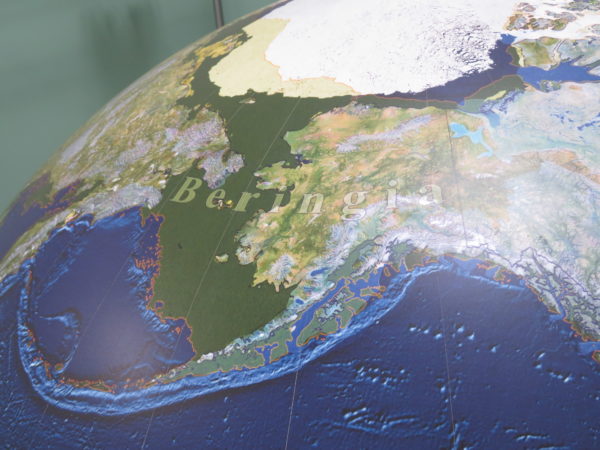
When we researched things to do in Whitehorse we were surprised to learn that northern and central Yukon, eastern Siberia, and Alaska were ice-free during the Ice Age. Sea level was lower because so much water was being held in glaciers and Siberia and Yukon were joined by the Bering Land Bridge for as much as 80% of the last million years. This land bridge is known as Beringia (it takes its name from the Bering Strait) and blocked Pacific moisture, preventing the formation of ice in the lowlands of the area. The Beringia Interpretive Center told us about all this and more.
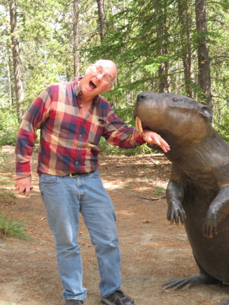
Beavers really were this big 10-15,000 years ago.
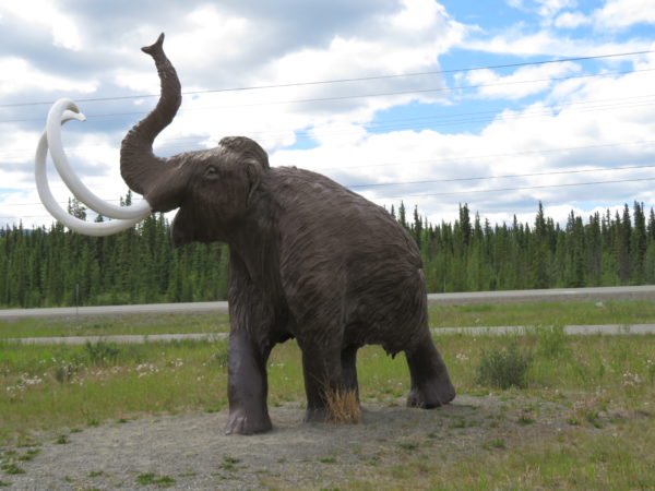
No museum featuring natural history would be complete without a tribute to mammoths and/or mastodons. Both animals lived in Beringia. The grounds of the center featured several woolly mammoth statues.
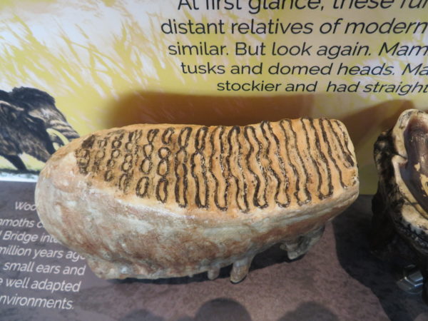
And inside were woolly mammoth molars with vertical ridges appropriate for grazing on grasses
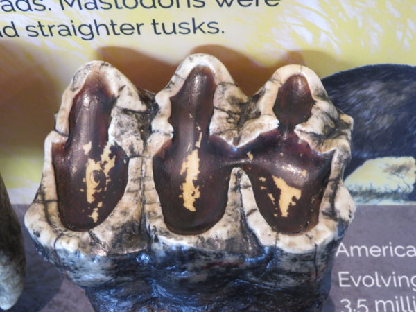
and mastodon molars with raised cusps appropriate for snapping and chewing on the branches of shrubs and trees.
The Yukon Transportation Museum is next door to the Beringia museum. One exhibit is the world’s largest weather vane, a DC-3!
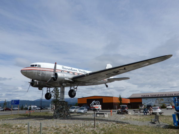
This plane was built in 1942 and flew transport missions in India and China during World War II. It has also been a passenger plane and a bush plane. It was retired in 1970 after it blew an engine on take-off and it became a weather vane in 1981. The plane spins in winds of five knots or greater.
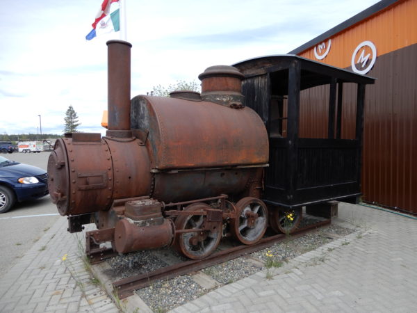
This Porter locomotive was built in 1888 and carried coal for the Dawson City power plant.
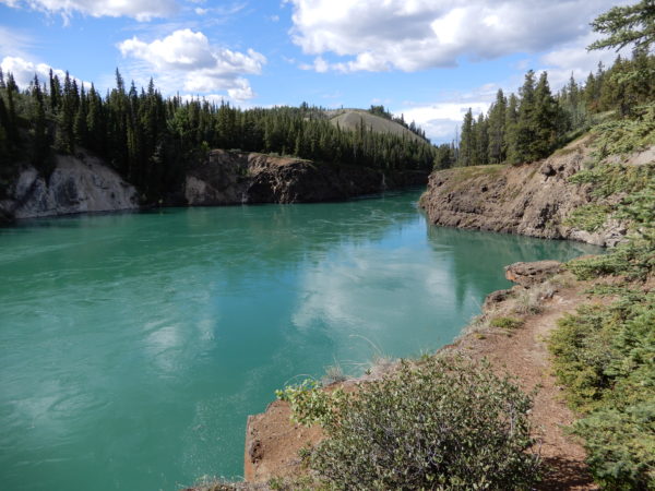
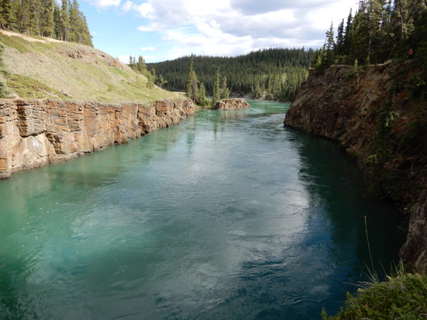
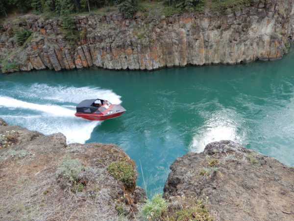
Miles Canyon
The Whitehorse Rapids flowed through Miles Canyon until the dam was built in 1959. The canyon walls are were formed about 8.5 million years ago from a volcanic vent about three miles away. The layer of basaltic lava is 360 feet deep, although only the top 32 feet are visible. Before the dam was built the water level was about 30 feet lower than it is today. The canyon was named for a U.S. Army officer by his lieutenant who was an explorer.
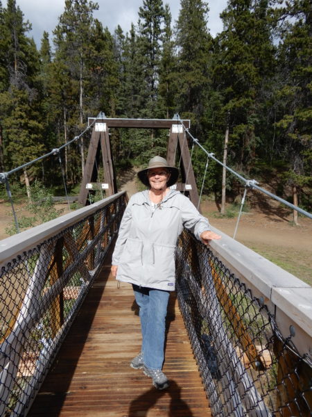
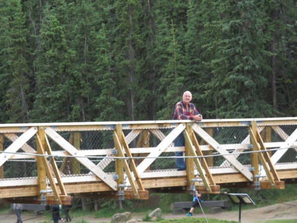
The suspension bridge was originally built in 1922. Jane’s fear of heights made her want to hurry over it, in spite of assurances from a local resident that it was really safe–it had been reconstructed just last year.
MacBride Museum
The MacBride Museum illustrates and preserves Yukon history.
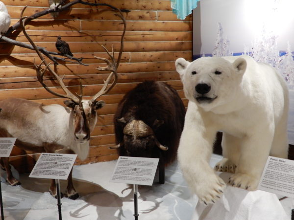
Animals including caribou, musk ox, and polar bear
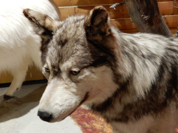
Wolf
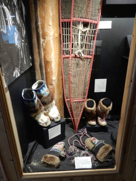
Gwitchen (First Nation) clothing and snow shoes
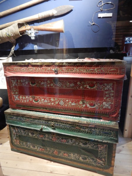
Tea chests from China were used by Russians who hunted in the Aleutian Islands
Robert Service moved to Whitehorse in 1904 and worked as a teller. In 1907 he published his first collection of poems which included “The Cremation of Sam McGee” in which a former Tennesseean who could never get warm is revived during his cremation and demands that the door be shut to keep out the cold.
There are strange things done in the midnight sun
By the men who moil for gold;
The Arctic trails have their secret tales
That would make your blood run cold;
The Northern Lights have seen queer sights,
But the queerest they ever did see
Was the night on the marge of Lake Lebarge
I cremated Sam McGee
McGee was a real person and the cabin in which he lived has been moved to Museum grounds. He wasn’t from Tennessee, however, he didn’t die in the Yukon, and he wasn’t cremated in the firebox of a sternwheeler, but the poem is a wonderful story.
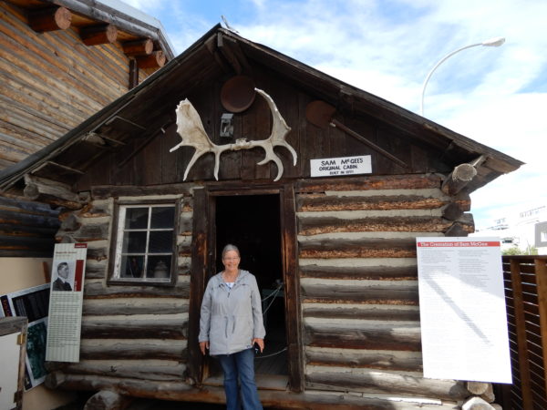
Jane in front of Sam McGee’s cabin
Inside Sam McGee’s cabin
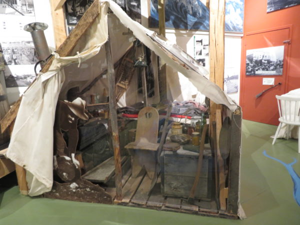
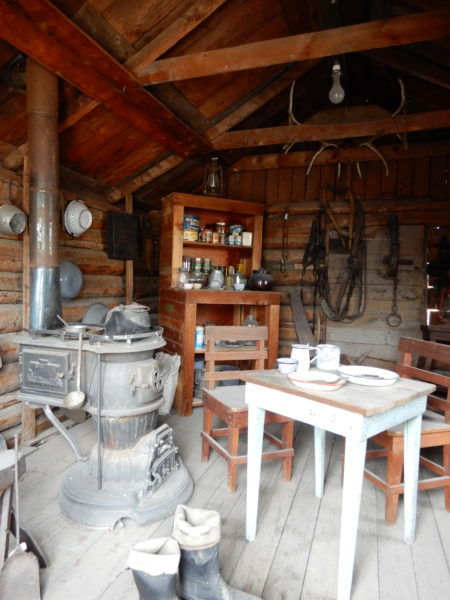
Sam McGee was mostly a construction foreman, but if he’d lived in a prospectors tent, it might have looked like this one.
As long as we’re feeling poetic, we’ll close our section on the McBride Museum with an anonymous thought about the construction of the Alaskan Highway:
The Alaska Highway, winding in and winding out,
Fills my mind with serious doubt
As to whether the lout that built this route
Was going to Hell or coming out!
Whitehorse Rapids Fishway
The Fishway was built to help salmon move past a dam which was built in 1959.
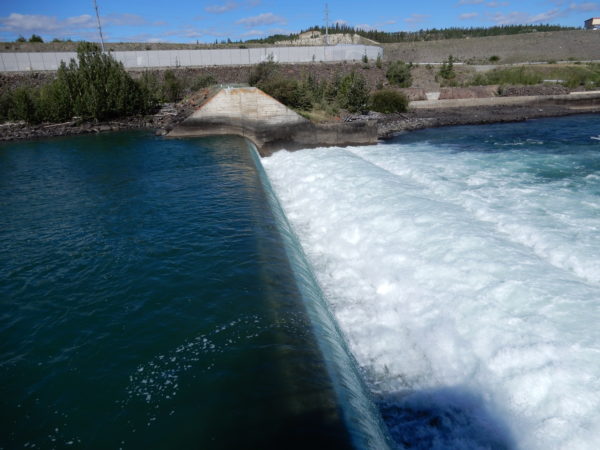
Whitehorse Rapids Dam
The fishway has a rise of 60 feet and, at 1,182 feet long, is the longest wooden fish ladder n the world.
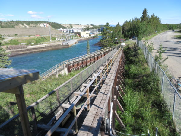 King or chinook salmon use this ladder to get to their spawning grounds. In doing so, they travel three months and 1,875 miles up the Yukon River from the Bering Sea. Only a small percentage successfully make the journey. Most are victims of predation, starvation (they don’t eat on their journey) or fishing.
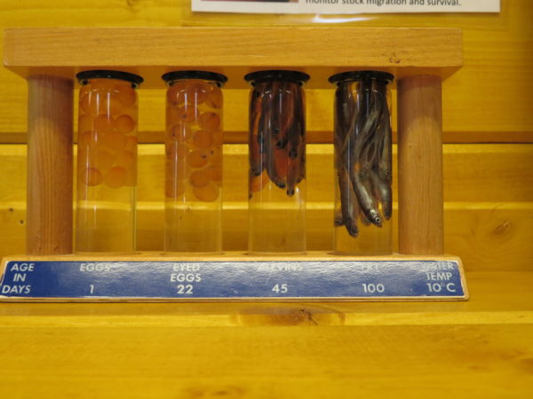
We learned about salmon development. The life stages of king salmon are egg, eyed egg, alevin, and fry.
We also saw models or replicas of three methods for hunting salmon.
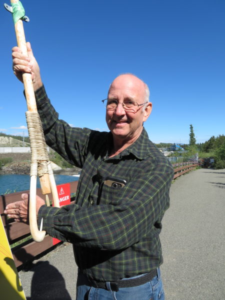
Salmon spear
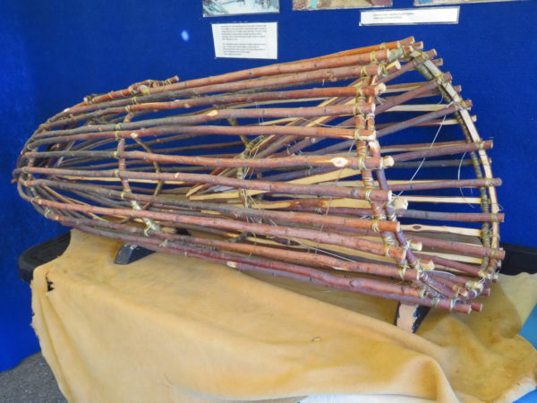
Fish trap
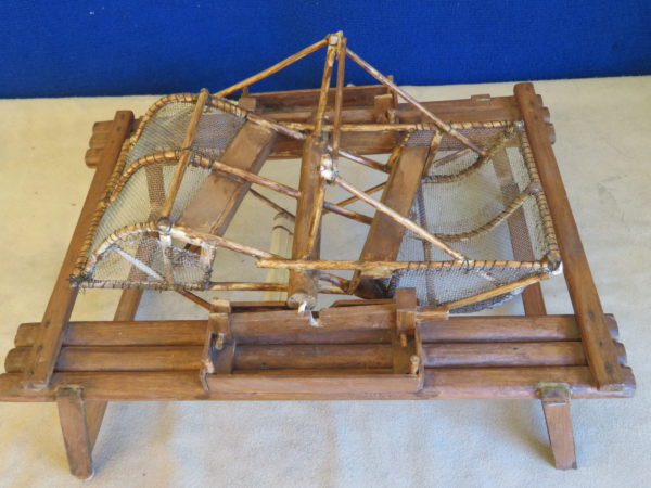
Fish wheel. The current turns the wheel. Fish swim over its two baskets, a caught as the wheel turns, and then fall into a box as the baskets rotate on the wheel.
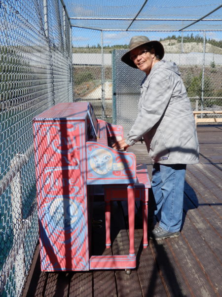
This pink piano on the boardwalk at the fish ladder is the first of a series to be placed in public places for people to play. Jane couldn’t resist playing “River” by Bill Staines there.
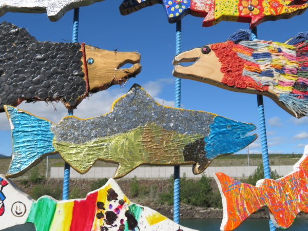
Many people, school classes, and other groups have decorated salmon for display at the fish ladder. Here’s a sample.
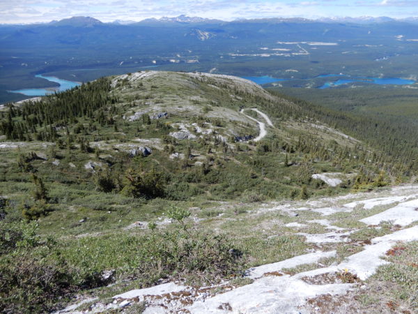
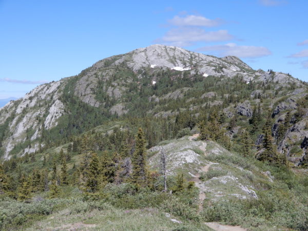
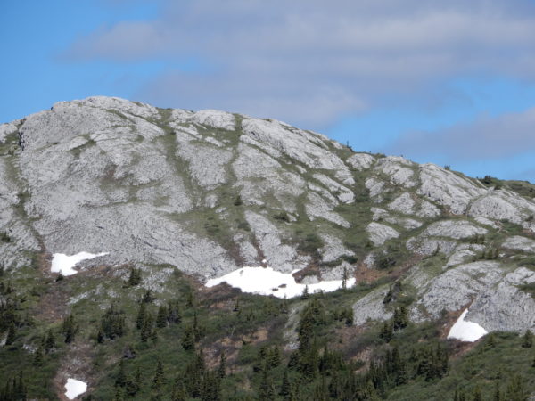
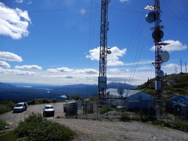
Gray Mountain
Gray Mountain (also known as Canyon Mountain) is made of limestone formed 220 million years ago as coral reefs in an ancient sea. The road to the summit is paved as one passes light development and then is dirt. Jane’s imagination was overactive as she and Dave crossed ruts and climbed steep sections, even though it’s a tame enough road that it’s used to access the communications equipment on the summit.
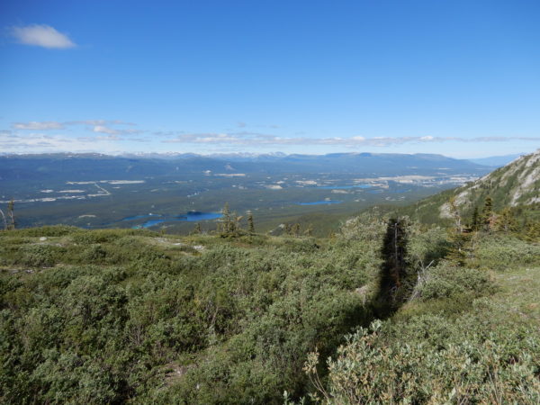
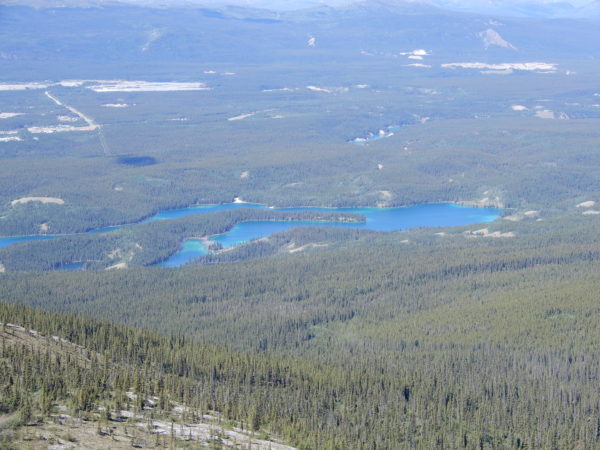
And on the way back to town:
2 Comments
Esther McAfee · August 11, 2018 at 7:35 am
How can two people pack this much adventure into one lifetime? I enjoy reading your journal. How many books do you plan to publish? Enjoy the beauty that Alaska has to offer. It is an amazing place.
Susan · August 11, 2018 at 9:22 am
This is so neat to see these great pictures and learn this history. I think RV travel may be the way for us to go in the future. You certainly make it look enticing!!